The Stanfield Chronicles
The Stanfield Chronicles
Home
Contents
Foreword and Excerpts
Key Historical Figures
Bartholomew Gosnold
George Weymouth
Samuel de Champlain
Sir Ferdinando Gorges
Captain John Smith
Thomas Morton
Richard Vines
David Thomson
Rev. John White
William Whiteway
William Bradford
Roger Conant
William Blackstone
John Endicott
John Winthrop
Stanfield Characters
Maps in the Books
Southwest England
Europe
New England
Bermuda
Salem Peninsula 1630
Boston Harbor 1630
Merrimack to Boston
Merrimack River
Marine – vessels, navigation and Nautical terminology
The Sweet Rose
The Swallow
Shallop
Navigation
Nautical Terminology
Historical Context
Maps
Map of Plymouth in 17th century
Map of Dorset – southern portion
Chart between England, La Rochelle and Bilbao
17th century map of London
Map of New England
Beauport (Gloucester) – Samuel de Champlain’s map 1604
Saco – Samuel de Champlain’s map 1605
Boston Harbour – Samuel de Champlain’s map 1607
New England Coastline – Samuel Champlain’s map 1607
New Plimouth Harbour (Port Saint Louis)- Samuel Champlain’s map 1605
Map of Bermuda
Trading Companies
Virginia Company – established 1606
The Somers Isles Company – established 1612
Council for New England – established 1620
Dorchester Company – established 1623
Massachusetts Bay Company – established 1628
Voyages to New England
New England map
New England Indians
Indians brought to England
Places
Dorchester, Dorset
The Great Fire of Dorchester 1613
Plymouth, Devon
La Rochelle, France
Leiden, Holland
The Church
The Twelve Days of Christmas
Piracy
The Mercedarians – The Order of the Blessed Virgin Mary of Mercy.
Ordering a Book
Speaking Engagements
Books
Awards
Reviews
About the Author
Stanfield Characters
X
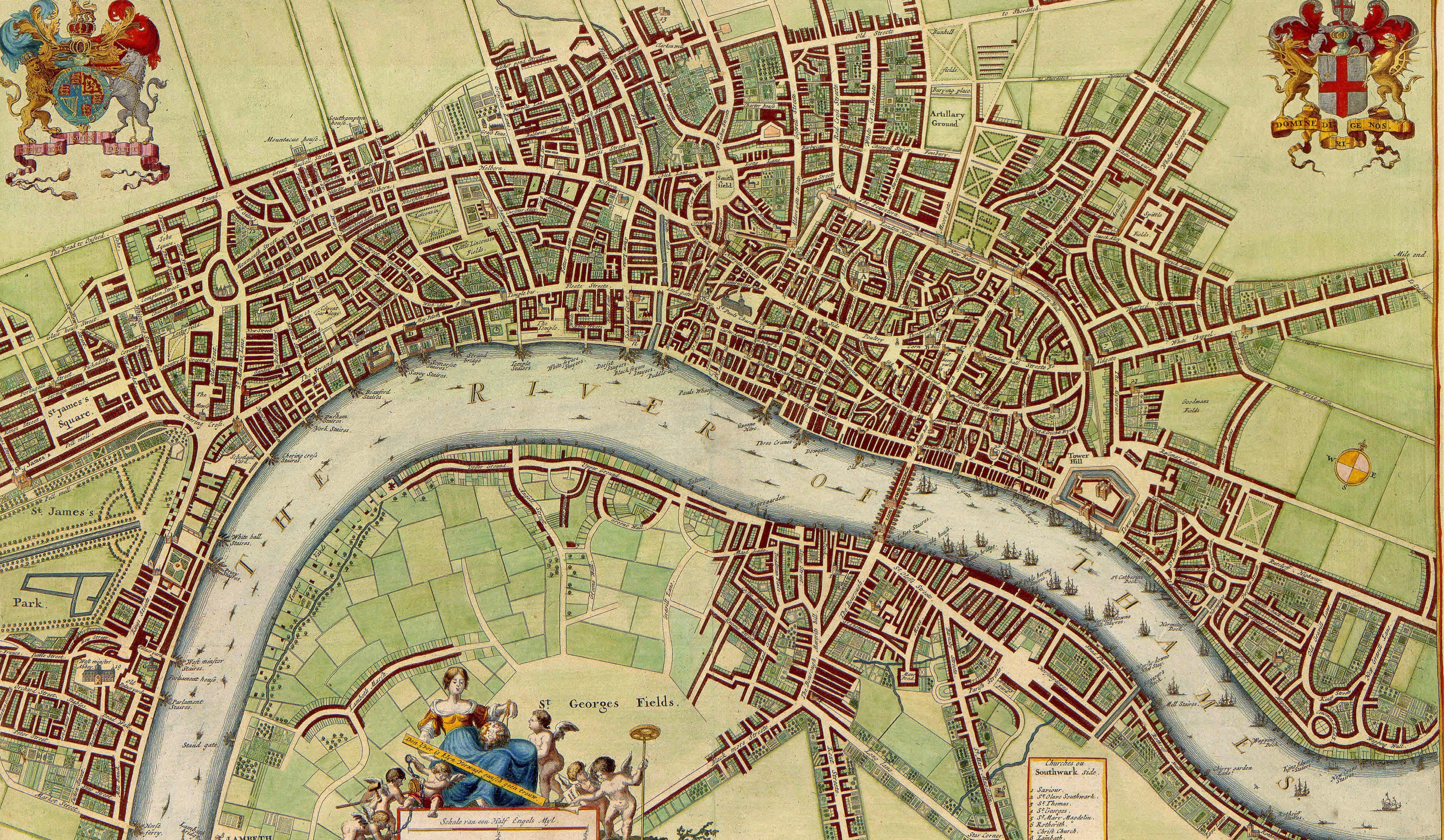
17th century map of London
WikiCommons 17th_century_map_of_London_(W.Hollar)
Return to Maps